This blog provides information, stories, links and events relating to and promoting the history of the Wimmera district.
Any additional information, via Comments, is welcomed.


Showing posts with label Stawell. Show all posts

Thursday, 26 July 2018

Melbourne comes to Stawell

All images by Abandoned Melbourne
At the beginning of the month Abandoned Melbourne, (a Facebook page who visit & photograph derelict buildings & sites of general public interest, and share the images so you don't have to take the risks going to these places) obtained permission to record at Pleasant Creek in Stawell. Here are a sample of their images, and their history of the site.
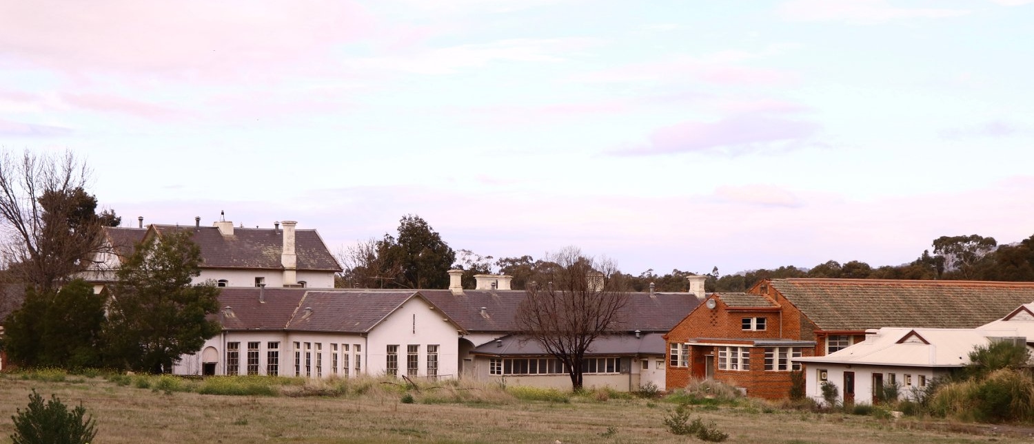
Their images have created a time capsule of the site after its closure and before any re-development.
In 1861, the Pleasant Creek Hospital opened as a medical facility for the population of Stawell and district. The Syme Ward building for convalescent patients was added in 1904.
In 1933, the facility was replaced by a newly-built hospital in the town of Stawell. In 1934, the Mental Hygiene Department acquired the old Pleasant Creek Hospital site and converted it to accommodate children with disabilities, which became Pleasant Creek Special School. 
The first residents (18 boys) were admitted in 1937 from Royal Park Depot.
At the end of 1937, there were 98 children living at Pleasant Creek. In 1968 it was renamed Pleasant Creek Training Centre, caring for people with intellectual disabilities.
From the 1950s to the 1980s, there were several building developments:
1957, Lonsdale Unit expanded capacity to 113
1969, Bellfield and Fyans Units increased numbers to 196
1977, Alexandra Unit converted to recreational and lecture room facility.
1977, Day Centre, Nurses' Home and Clinical Services Administration buildings
1985, Nara Unit closed for renovations and residents moved to the previous staff living quarters.
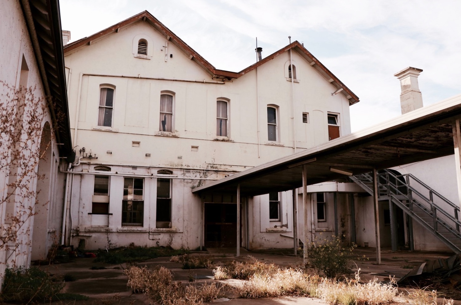
Interior of the Lonsdale/Bellfield/Fyans unit.
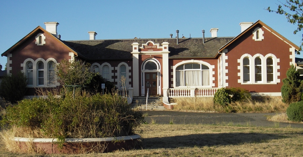
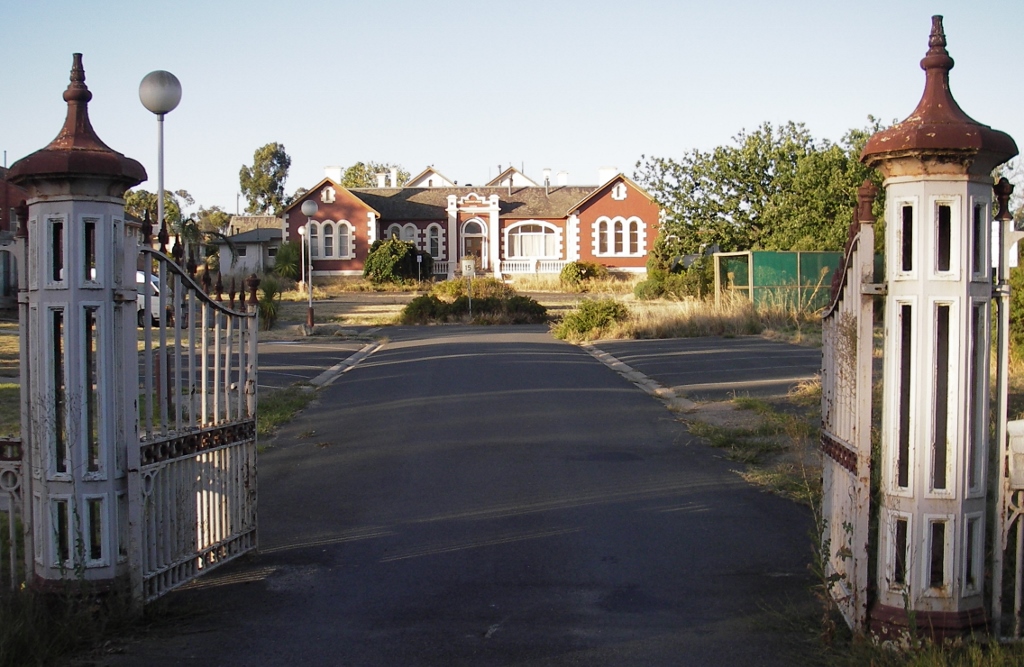
During the 1980's, Pleasant Creek Training Centre housed up to 140 male and female residents, aged 10 to 45 with mild to profound levels of intellectual disability, in five residential units and four on-site houses. Services were aimed towards community repatriation. The Centre provided respite care to residents from the local community and used generic services from recreational to medical.
The Concert Hall
The Intellectually Disabled Persons' Services Act 1986 abandoned the previous ‘medical model’ that defined disabilities as illnesses, for a ‘care model’ based on the philosophy that the disabled should not be ‘warehoused’ in institutions, and care of intellectually disabled persons was reallocated to the Community Welfare Services Department.
In 1986, the Centre had about 160 residents, each client now had to be given opportunities to realise his or her full potential. General and individual service plans were created to direct each person’s development. 

In 1988, the report commissioned on Intellectual Disability Services recommended the dismantling of institutions for the disabled, to be replaced by smaller facilities. It recommended that Pleasant Creek be closed by 1993, which did not eventuate.
In 1990, an independent inquiry was ordered into allegations of sexual assault at Pleasant Creek. In response to the “Jude Wallace Report” (as it was known), Community Services Victoria and Pleasant Creek Training Centre developed mechanisms which lead to improved systems for the reporting of incidents & improved standards of service delivery.

 From 1990, Pleasant Creek provided residence, education and training facilities for 113 intellectually disabled people of varying ages from late teens to mid 50's.
In 1996, the Victorian government announced the impending closure of Pleasant Creek, in favour of 'community living' options for its residents, and the facility closed in 1999.
Thank you to Pleasant Creek for letting Abandoned Melbourne freely explore the hospital, and thanks too to Abandoned Melbourne for the visual record. Follow along on Pleasant Creek’s Facebook page to see the works being done and future dates for tours.The buildings are currently being cleaned up to be a business & tourism hub.
Then check out Abandoned Melbourne’s Facebook page, there are many more photographs on their Page, and they don’t just limit themselves to Melbourne (the Profile pic is at the Sister Rocks near Stawell).

Thursday, 21 September 2017

Pleasant Creek site

The Pleasant Creek Hospital site has finally been leased. New owner Keenan Quinsee intends to open some of the buildings for Aradale-style ghost tours. More details on the plans in the Wimmera Mail-Times article, and photos of the buildings in the Stawell Times-News article.


Pleasant Creek Centre was the site of the first local hospital in Stawell, which was opened in 1850 (the only hospital in western Victoria between the South Australian border, Ballarat and the Murray River. Local landowners and miners subscribed to its construction. It was reserved in 1861 and again in 1883. Part of the building remains on the site, there were more elaborate alterations in 1881, it featured a Benevolent Ward for elderly miners. The area has a long history of community use, initially as a health service and subsequently as the Pleasant Creek Training Centre, an area where people with intellectual disabilities were accommodated and educated and participated in day programs.

 For many years a school was located on the site as well as accommodation for children, teenagers and latter disabled adults. Following changes to intellectual disabled housing policies, the Human Services Department transferred the clients from the Pleasant Creek Centre into community housing.

Parliamentary legislation removed the final reservation on the land and the 13 hectares was identified as having no further public purpose and had been for public sale since 2008.

Wednesday, 19 July 2017

Wimmera fiction

The recently released novel "Wimmera" by Mark Brandi is largely set in the Stawell area with references to the Black Range & the Grampians, Barnes Street, the Overland train, Halls Gap with a football team.

It is peppered with late 1980’s social culture - Ita and the 'Women’s Weekly'; 'Spycatcher' (remember MI5 senior intelligence officer/spy Peter Wright’s autobiography and the ruckus it caused?); TV shows like 'Monkey Magic', 'Hey Hey It’s Saturday', 'Wonder Years', and the 'A-Team'; films like 'Witness' with Harrison Ford, and when there was only one 'Terminator' movie. 
 
The story begins in the long, hot summer of 1989, Ben and Fab are best friends. Growing up in a small country town, they spend their days playing cricket, yabbying in local dams, wanting a pair of Nike Air Maxes and not talking about how Fab's dad hits him or how the sudden death of Ben's next-door neighbour unsettled him. Almost teenagers, they already know some things are better left unsaid. Then a newcomer arrived in the Wimmera. Fab reckoned he was a secret agent and he and Ben staked him out. Up close, he looked strong. Maybe even stronger than Fab's dad. Neither realised the shadow this man would cast over both their lives. Twenty years later, Fab is still stuck in town, going nowhere but hoping for somewhere better. Then a body is found in the river, and Fab can't ignore the past any more.
A foggy morning on the Wimmera River
Part one is told in 12 year old schoolboy Ben’s voice: long, hot days of camping, schoolyard bullying, sexual awakenings, a new neighbour and a sense of the ominous in the surrounding adult world.
Part two is told in Fab’s adult voice: at 28 years old and in the same town working in a shop, with dreams of better things, looking back while trying not to.
Part three is set in the present time, and unravels the full story after a body is found in the creek.

Originally from the Marche region in Italy, Mark Brandi grew up Italian in a rural Victorian town which influences much of his work. Mark graduated from a criminal justice degree and his career includes roles as a policy advisor and project officer in the Department of Justice, before changing direction and deciding to write.
"Wimmera" is his first novel, and won the British '2016 Crime Writers' Association Debut Dagger award'.

Thursday, 4 August 2016

To visit or not to visit

Spencer Street Passenger Yard, 1884 (SLV)
I was looking for something totally different, when I came across the "Victorian Railways tourist's guide : containing accurate and full particulars of the watering places, scenery, shooting, fishing, sporting, hotel accommodation, etc. in Victoria ; also a new and complete railway map showing all the present and projected lines" edited by Joseph Pickersgill, published by Sands & McDougal in 1885, and available online via Trove at http:/​/​nla.gov.au/​nla.obj-268214772


It describes the towns and cities in Victoria at the time, and really was not that complementary about this area, especially as it was a 'tourist guide'.


 ARMSTRONGS,
Which is not famous for anything in particular, and about six miles further on is
GREAT WESTERN.
This important place lies in undulating country on the Concongella Creek, a tributary of the Wimmera River, and to the north of the Black Range, and is the centre of a magnificent wine-producing district. Here, amongst other smaller ones, is the justly celebrated Great Western vineyard (Best's), famous for its extensive cellarage, and above all for the excellence of the wines of all kinds produced there, which have taken prizes at most of the World's great Exhibitions. A visit to this place will amply repay the tourist's time if only to
"Sit 'neath the shade of the spreading vine,
And drain a deep draught of Great Western wine,"
From Great Western to
STAWELL,
Also known familiarly as Pleasant Creek and the Reefs, is about 8 miles, being 19 miles from Ararat, 76 miles from Ballaraat, and 176 miles from Melbourne. Stawell is a large and somewhat straggling place, the streets in the old part of the town in particular being narrow and tortuous. In fact, the top end of Main Street (the Collins Street of Stawell) is as crooked as a dog's hind leg.

One wonders whether the author got a sample of some Best's sparkling, as he/she is a bit scathing of everywhere else, and it continues -

GLENORCHY,
Eight miles north-west of Stawell, and on the line of railway, is a pastoral township of the smaller type. The native name is Djarrah, which means a job of work. It is only noticeable as being the starting-place for
BALMORAL,
A place of about equal calibre. The only reason for mentioning these out-of-the-way townships is that the road between them passes through Rose's Gap, a gloomy, precipitous gorge in the Grampians, well deserving a visit, whose native name, Barregowa - meaning Middle of the Mountain - sufficiently indicates its character.
Quitting Glenorchy, the train passes the little townships of LUBECK and MURTOA, and proceeds to the comparatively large town of
HORSHAM,
The most important and the liveliest place in this part of the country. It is the centre of a flat agricultural and pastoral district, some of the finest grazing land in the country being in the neighborhood. The botanical gardens, as in the cases of Koroit and Stawell, were laid out by Mr R.P. Whitworth under the supervision of Mr W.R. Guilfoyle. Horsham has two newspapers, the 'Times' and the 'Wimmera Star'. The town possesses no special attraction, except to those who wish to see pastoral country, and it is questionable whether it is worth coming so far to see so little. It may be remarked that it was in this part of the colony that the late Marcus Clarke gained his colonial experience.
The pastoral centres of Dimboola and Tarraginnie lie still further afield, but whether to visit them or not is purely a matter of choice. 
Steam train passing through farm land c1890-1900 (SLV)
So what were the chances of getting a special excursion train to visit the Wimmera in the 1880s, based on this guide?

Friday, 15 February 2013

Railways - Tramways

To conclude this series on local railways, is a final post devoted to the district tramways.
Grampians Tramway - a tramway was built from Stawell to carry Heatherlie quarried stone to the main railway line.
Embankment at Stawell West, where the line crossed the Wimmera Highway
Trolley at the Heatherlie Quarry
The Mt Difficult Heatherlie “Grampians freestone” sandstone quarry, was established in the early 1860s. The quarry employed between 100-150 men. The Heatherlie township was surveyed in in the 1880s, but most workers preferred to live in Stawell Large quantities of stone were taken from the quarry between 1880 and 1930, demand dropped with the Depression of the 1890s and the quarry closed in 1892/93. It operated spasmodically between 1900 and 1938, and closed again in 1938, due to lack of orders. It finally ceased major operations in 1941. Heatherlie stone was used for several local buildings in Stawell, including the Court House, the Town Hall, the Anglican Church and St Patrick's Roman Catholic Church. The stone was also used on the construction of significant public sites in Melbourne – Parliament House, the State Library & Melbourne Town Hall.
Stawell, taken by Mark Bau standing on the Grampians Line in 1982
In 1881, a contract for construction of a government-financed Stawell to Heatherlie branch railway was signed. The tramway was 15 miles long and used 50lb rails, Victoria Railways constructed sidings at Fyans Creek in 1885, and at the quarry in 1886. The first train of stone from the quarry reached Stawell in February 1882. Stone was moved in blocks weighing up to 11 tons. The line was duplicated from the Grampians Junction to Stawell Station in 1889. There were also sidings for the Stawell Brickworks which was abolished in 1965, and a siding for the Stawell woollen mills, and a flour mill siding close to the Stawell station.
Line to the sidings - grain silo on left, woollen mill chimney (white), brickworks chimney (centre), Grampians line parallel to Melbourne line on the right.
For many years after its construction tourists and day-trippers also used the line. The railway line was officially closed in 1949 and dismantled in 1950s. There are a few remnants still visible - raised earth, some of the sleepers and a few rails still in place at the end of the line.
The Melbourne line, Grampians line & sidings line looking towards the Stawell station
A Rail Trail following the Grampians line starts at Stawell West, and heads west towards the Grampians the first 2.5km are on a path south of the original easement. The rest of the trail (about 9km) is along the old rail alignment, parallel to Mt Dryden Rd. and close to Lake Lonsdale. At Heatherlie, the trail can be walked for about 1.5km towards Stawell.
The Grampians tramway walking track at Heatherlie
Warranook (Wal Wal Ballast Pits Line) Tramway
The Warranook tramway was constructed to access the gravel pits providing railway ballast for the Murtoa-Warracknabeal section of the Patchewollock line. The tramway ran from Wal Wal station name changed from Warranook to Wal Wal in 1887) to Riachella just over 5 miles away. It was constructed in 1884-85, with a timber bridge over the Dunmunkle Creek. Gravel was extracted from a number of sites until 1906, later sections were utilised for timber gathering, and in 1920s for carrying wheat. The line was dismantled in 1936. The Riachella Tramline Road is now on the alignment of the tramline. 
Riachella
 McKenzie Creek Tramway
The Horsham Borough Council and the Shire of Wimmera operated the McKenzie Creek Tramway to a stone quarry which transported road making materials from McKenzie Creek (about 8kms south of Horsham) on second-hand railway trucks hauled by horses. One truck at a time was hauled up the hill from the quarry, then two horses together pulled the load to the depot at the showgrounds. The McKenzie Creek quarry was the nearest source of suitable stone for roadwork improvements. Firewood for the brick kilns near the Wimmera River bridge were also conveyed along the tramline.

A picnic group using the McKenzie Creek tram, 1920 from "Horsham in focus"
Construction of the line from the top of McPherson Street in Horsham began in 1884 and the horse tramway opened in 1885 and ceased operating in 1927. The tramway was dismantled as unemployment work during the Depression, and the rails sold for telephone poles. Special picnic trains operated from time to time conveying residents in open wagons for picnic parties at Bungalally.
McKenzie Creek Quarry site today

 Mt Zero Quarry Tramway
The Mt Zero Quarry provided beaching stone used in the construction of Taylors Lake (1919) and Pine Lake (1928) storages. The horse-drawn tramway was laid down from the quarry to Taylors Lake and later lifted and moved to Pine Lake. The formation is still visible in places.
Mt Zero from south of Taylors Lake
Sources: "A history of the Grampians Tramway" R.K. Whitehead, "Horsham in focus" Noelene Jenkinson & Marie Foley, "A story of Horsham" Brian Brooke & Alan Finch, Mark Bau's VR.net site.

Saturday, 29 December 2012

Railways - Melbourne to Adelaide line


The Melbourne to Adelaide or Western line runs through much of this region. It is the home of 'The Overland' passenger train. The line was extended from Ballarat to Stawell in 1876, Murtoa in 1878, Horsham in 1879, Dimboola in 1882 and linked with the South Australian Railways at the border station of Serviceton in 1887. The line was converted from broad to standard gauge in 1995.
Stawell station building at night (from "C.R.S.V.")
Seppelt's siding was a short distance on the Melbourne side of Great Western and served the Seppelt winery. The buildings shown are part of Seppelt's Great Western wine complex that was serviced by Seppelt's siding in 1981. The mountain in the background is Mt Langi Ghiran. (from VR.net)

Great Western passenger services ceased in August 1993 and this substantial brick station was demolished.
Great Western station, looking to Stawell, 1970 (from "VR stations & stopping places")
Stawell arrived in May 1876. Train passenger services have stopped and been replaced by V-Line buses. The station building is now an art gallery.
Melbourne bound steam passenger train at Stawell, 1968 (from "C.R.S.V.")
Signal boxes in the Stawell rail yards, 1984 (from "C.R.S.V.")
Deep Lead 
Deep Lead in 1970 (from "VR stations & stopping places")
'Water them geraniums' the neglect of Deep Lead (from VR.net)
Glenorchy 
Wal Wal
Wal Wal in 1981 shortly before the signals, building & platform were removed (from VR.net)
Lubeck was the junction for the Bolangum branch line.
Lubeck in 1981 (from VRnet)
Marmalake the Marmalake grain terminal (colloquially known as the Stick Shed) south of the town, is in the background of the photo below.

Murtoa in its heyday (from "C.R.S.V.")
Murtoa is on the main Western line, and at the junction for the branch line to Patchewollock. The railway arrived in December 1878. Passenger services were withdrawn in 1993, and Freight Australia use the station building, as Murtoa is still an important grain and freight stop.
The signal box and rail motor dock platform at Murtoa in 1978 (from "C.R.S.V.")
The original intention was to take the line direct from Murtoa to Dimboola passing through Jerro, but Horsham could not be bypassed, so the line looped south-west.
Jerro was north of the line, so a new railhead town of Jung or Jung Jung was established in 1878.
Jung, looking towards Murtoa 1982 (from VR.net)
Dooen was almost demolished by a derailment in the late 70's requiring the front of the signalbox to be replaced and the platform to be drastically cut back. Dooen was closed to passengers in 1972.
Dooen, back in 1885 (Museum Victoria's collection)
Dooen nearly 100 years later, in 1982 (from VR.net)

Overlooking Horsham in 1957 (from "C.R.S.V.")
Horsham The railway reached town in February 1879. It was the junction for the Natimuk East and Carpolac branch lines. The 'Overland' passenger service passes through Horsham, which is also a major intra-state freight depot, though containers have recently moved from the Mill Street site to the new Dooen Freight Hub.
Horsham station and yard in 1975 (from "C.R.S.V.")
A quieter Horsham today - no signal box, & derelict flour mill in the distance
Dahlen Siding
Pimpinio the station buildings and goods shed have been removed, only the silos and platform mound remain.

Pimpinio station (from VR.net)
 Wail little remains of the Wail station, even most of the peppercorn trees have been removed.
Wail building, with the highway overpass in the background (from "C.R.S.V.")

Dimboola looking west to the border, 1962 (from "C.R.S.V.")
Dimboola farmers from the Dimboola Village Settlement (experimental closer settlement irrigation colony, between Wail and Dimboola) helped build the railway embankments. The railway reached Dimboola in July 1882. It was an important junction when the  Yaapeet branch line to Jeparit opened in 1894. It was and still is a driver/crew changeover stop.The large AWB Dimboola Grain Centre is just off the highway to the west of the town.
Station building & signal box in 1971 (from "C.R.S.V.")
The station building now
A diesel railcar passenger service ran from Serviceton to Dimboola and connected with the Melbourne passenger train. The service ended in December 1978. 
Gerang Gerung even the platform mound has been demolished at Gerang, with the silos the only evidence of the station.

Serviceton passenger service at Gerang in 1976(VRnet)
Kiata
Track gang near Kiata in 1968 (from "Patterns of steam")
The Salisbury silo in the foreground with the Kiata silo in the distance
Salisbury As trains got longer in the late 60's the existing crossing facilities were proving inadequate, so in 1970 the Salisbury loop was built as a pure crossing loop, having no goods sidings. It was equipped with 3 position signals, the points controlled by motors, not manually and a signal panel. It was able to be "switched out" in less busy times thus saving on manpower.
A goods train at Salisbury, 1986 (from VR.net)
 Nhill reached 1886, but the station building came later. New GEB silos were constructed in 1963.
Nhill station building
Locals petitioned for a siding at Tarranginnie in 1884, and the railway reached it in 1887. A permanent township was planned, but never eventuated, though a Post Office, store shed were constructed. The wheat silos were erected in 1939 allowing bulk handling.
The rusting rails of the Tarranginnie siding beside the main line

 
Diapur station building in 1971 (from "VR stations & stopping places")
Diapur less relevance once CTC was introduced on the new standard gauge in 1995. Before weighbridges and bulk handling, each bag was individually weighed on a set of scales.
The weigh-bridge & water-tank at Diapur
Miram
The Miram West Rd crosses the tracks  approaching Miram
Kaniva
A boarded-up Kaniva station building
Dimboola-Serviceton goods train at Kaniva, 1967 (from "Patterns of steam")
Changes - the same view today
Lillimur
An already derelict looking Lillimur in 1971 (from "VR stations & stopping places")
The town of Serviceton (named after former Victorian Premier - Sir James Service) was gazetted on 1st January 1887, while the line was opened on 19th January 1887. It became a major border crossing and an important customs station for goods passing between the colonies of South Australia and Victoria.
Passenger train stopped at Serviceton, 1961 (from "C.R.S.V.")
Post-steam Serviceton in 1978 (from "C.R.S.V.")
A Late Victorian railway station was built in 1887 of red bricks transported from Horsham. The building opened in 1889. From the front, it had a central two storey symmetrical neo-Classical polychromatic brick station building. The ground floor level consisted of 15 main rooms, and accommodated toilets, waiting rooms, dining and sitting room, bar and kitchen, offices, lobby and customs office. The enormous 70-metre platform with cast iron posted verandah was the longest in the State, until a portion was removed in the late 1980s. The station was closed in 1986.
Serviceton now
Further information and photographs at Shane McCarthy's "Patterns of steam" and Neville Gee's "VR stations and stopping places" and John Sargent's "Country railway stations Victoria" series  and Mark Bau's VR.net site.