This blog provides information, stories, links and events relating to and promoting the history of the Wimmera district.
Any additional information, via Comments, is welcomed.


Showing posts with label Murtoa. Show all posts

Friday, 14 August 2020

75th Anniversary (6: 1944)


Day 6: 1944 
This year saw a number of local airmen in the news -Don Dripps lost over Berlin, Ronald Scott of Murtoa killed in America, Bert Smith of Horsham a Squadron Leader of Sunderlands, Ted Turk shot down above New Guinea, Len Netherway from Quantong ditched in the sea...
 
On the Home Front, the situation was dire with a shortage of chocolate. The advert below imploring everyone to reserve Freddo frogs for children.

Friday, 24 July 2020

Location, location

A short film by Matthew Bird has captured a number local iconic locations around the Wimmera and Mallee.
'Parallaxis' is an abstract 16-minute psychological sci-fi film, with 2 'future characters' (played by Ashleigh McLellan and Lilian Steiner) who move across the landscape pushing & controlling large cylindrical instruments that survey & map the terrain.
Bosisto's Eucalyptus Distillery ruins
The terrain in question is recognisable as the site of Bosisto's eucalyptus distillery at Antwerp, the wind farm at Murra Warra, the Stick Shed at Murtoa, and Lake Tyrrell at Sea Lake.
Passageway, Stick Shed
The film follows two augmented humans as they "investigate their possible archaic genealogy in a Wimmera past. Arriving temporarily and somewhat unexpectedly in the now, the inquisitive duo put their surveillance face-halos to work: observing, recording, archiving ephemeral moments and navigational discoveries as they speed through the landscape. Their biomechanically engineered apparatus are cross-fed into the telemetry of the full-body gyrocompass each visitor operates. Systems in systems, wheels within wheels, spin-axis atop spin-axis, each revolution another attempt to locate and momentarily fix a collective bearing in space and time".

Saturday, 6 April 2019

Stick Shed by drone

Some great video of the Stick Shed by the ABC Western Victoria crew.
 
(Video from ABC Western Victoria's Facebook page)
The Murtoa Stick Shed is a National Heritage listed building (Australia's 101st), constructed in the 1940’s to store grain. It is now in high demand by tourists who want to see this iconic building.
Originally it only re-opened for the Murtoa Big Weekend in October each year, then once a month, now it is open 6 days per week!
Tourists are coupling the Stick Shed with the Silo Art Trail.
Opening times are: Tuesday-Saturday 10am to 12:30pm and Sunday 10am to 2pm.

Wednesday, 1 March 2017

The 'School Bus' Tour

As part of the National Trust’s Heritage Festival, a hosted bus tour of some of the rural and town school sites surrounding Horsham will be conducted. The tour will visit a number of marked and unmarked school sites, and some abandoned school buildings. Narrative on the tour will include the history of various schools and stories of the districts. 

The 'School Bus' Tour will be conducted on Sunday 30th April 2017, from 1pm to 5pm.
The cost is $25:00 per person. Numbers are limited to the bus capacity, so bookings are essential. To book either visit the Horsham Library, or phone 5382 5707 or for library members registered with Proscribe – go to proscribe.net./subscriber/login.php.
The meeting place is at the bus in the Mibus Centre Carpark, 26-28 McLachlan Street, Horsham. Free parking available at the Mibus Centre Carpark.
Attendees will encounter some steps and uneven surfaces. Refreshments will be available enroute. More details at the National Trust site.
Other National Trust Heritage Festival events include ‘Sir Samuel Speaks’ a Mother’s Day high-tea at Longerenong Homestead.

Thursday, 4 August 2016

To visit or not to visit

Spencer Street Passenger Yard, 1884 (SLV)
I was looking for something totally different, when I came across the "Victorian Railways tourist's guide : containing accurate and full particulars of the watering places, scenery, shooting, fishing, sporting, hotel accommodation, etc. in Victoria ; also a new and complete railway map showing all the present and projected lines" edited by Joseph Pickersgill, published by Sands & McDougal in 1885, and available online via Trove at http:/​/​nla.gov.au/​nla.obj-268214772


It describes the towns and cities in Victoria at the time, and really was not that complementary about this area, especially as it was a 'tourist guide'.


 ARMSTRONGS,
Which is not famous for anything in particular, and about six miles further on is
GREAT WESTERN.
This important place lies in undulating country on the Concongella Creek, a tributary of the Wimmera River, and to the north of the Black Range, and is the centre of a magnificent wine-producing district. Here, amongst other smaller ones, is the justly celebrated Great Western vineyard (Best's), famous for its extensive cellarage, and above all for the excellence of the wines of all kinds produced there, which have taken prizes at most of the World's great Exhibitions. A visit to this place will amply repay the tourist's time if only to
"Sit 'neath the shade of the spreading vine,
And drain a deep draught of Great Western wine,"
From Great Western to
STAWELL,
Also known familiarly as Pleasant Creek and the Reefs, is about 8 miles, being 19 miles from Ararat, 76 miles from Ballaraat, and 176 miles from Melbourne. Stawell is a large and somewhat straggling place, the streets in the old part of the town in particular being narrow and tortuous. In fact, the top end of Main Street (the Collins Street of Stawell) is as crooked as a dog's hind leg.

One wonders whether the author got a sample of some Best's sparkling, as he/she is a bit scathing of everywhere else, and it continues -

GLENORCHY,
Eight miles north-west of Stawell, and on the line of railway, is a pastoral township of the smaller type. The native name is Djarrah, which means a job of work. It is only noticeable as being the starting-place for
BALMORAL,
A place of about equal calibre. The only reason for mentioning these out-of-the-way townships is that the road between them passes through Rose's Gap, a gloomy, precipitous gorge in the Grampians, well deserving a visit, whose native name, Barregowa - meaning Middle of the Mountain - sufficiently indicates its character.
Quitting Glenorchy, the train passes the little townships of LUBECK and MURTOA, and proceeds to the comparatively large town of
HORSHAM,
The most important and the liveliest place in this part of the country. It is the centre of a flat agricultural and pastoral district, some of the finest grazing land in the country being in the neighborhood. The botanical gardens, as in the cases of Koroit and Stawell, were laid out by Mr R.P. Whitworth under the supervision of Mr W.R. Guilfoyle. Horsham has two newspapers, the 'Times' and the 'Wimmera Star'. The town possesses no special attraction, except to those who wish to see pastoral country, and it is questionable whether it is worth coming so far to see so little. It may be remarked that it was in this part of the colony that the late Marcus Clarke gained his colonial experience.
The pastoral centres of Dimboola and Tarraginnie lie still further afield, but whether to visit them or not is purely a matter of choice. 
Steam train passing through farm land c1890-1900 (SLV)
So what were the chances of getting a special excursion train to visit the Wimmera in the 1880s, based on this guide?

Tuesday, 21 June 2016

Such was life

This month the State Library’s “Our story : Such was life” is ‘The Mallee

In Victoria’s north-west lies the Mallee; a dry, hot region featuring sand dunes, salt bushes, shrubs and a ‘strange dwarf gum tree, Eucalyptus Dumosa, usually called Mallee…The tough land and climate certainly made an impression on Dr. Neumayer, a surveyor who recounted his experiences in 1864, ‘I can readily imagine why most people speak of this part of the country with a certain dread for there is actually no grass and no water to be found’…Over the years the land has endured its share of rural disasters, namely plagues (rabbits, mice, grass hoppers), drought and dust storms. Today its 100,000 occupants mainly reside in major towns like Mildura, Swan Hill and Kerang, but the Mallee is also dotted with smaller towns with delicious names such as Patchewollock, Cowangie, Boinka, Underbool, Piangil, Walpeup and Manangatang…In 1995 the State Library received a collection of photographs from the Rural Water Corporation (State Rivers & Water Supply Commission) which span the late 19th century to 1980. The thousands of images document Victoria’s water use and include many from the Mallee and Wimmera, which feature in this post.

Unfortunately some of the records have little or no information attached, they were grouped together under titles like:  [Wimmera - Mallee District] [picture], or [Wimmera region] [picture] with Accession no(s) RWP/1855; RWP/1870; RWP/1884; RWP/1883;RWP/1906; RWP/1862; RWP/1873; RWP/1926; RWP/1895; RWP/1932; RWP/1881; RWP/1878; RWP/1871; RWP/1872; RWP/1896; RWP/1923; RWP/1860

And Summary Descriptions: Shows sand drift on a Mallee farm, crops on Mr. Black's property, sheep at drinking storage at Dumosa, crops near Murtoa, ploughing at Murtoa, Miss Lodwick in her father's vegetable garden at Timberoo, interior of wheat storage shed in Murtoa, abandoned homestead at Galah, horses drinking from bore-water trough, Consolidated State School at Murrayville, bowling green at Ouyen, sand and crops at Patchewollock.
For some, it is easy to positively identify - for example the 'ploughing at Murtoa' can only be the 'RWP 1870' as the Stick Shed is visible in the background.
Ploughing at Murtoa (RWP 1870)
Likewise 'interior of wheat storage shed in Murtoa' is 'RWP 1884' a great shot of inside the Stick Shed.
Interior of wheat storage shed in Murtoa (RWP 1884)

 
Sand drift on a Mallee farm (RWP 1906)

It gets trickier with descriptions like 'abandoned homestead at Galah'. This is possibly 'RWP 1883' if you consider the building to look abandoned or derelict. Galah was a siding on the way to Walpeup.
Possibly abandoned homestead at Galah, it is RWP 1883

Another photograph which could be 'crops near Murtoa' or 'crops on Mr. Black's property' is 'RWP 1855'.  Mr Black's property was at Timberoo - north of Patchewollck and south east of Walpeup, and south west of Ouyen. Looking at the health of the crop and the vegetation in the background, it looks more like the Wimmera, than a really good year in the Mallee.

RWP 1855

From another catalogue record comes this graphic photograph, likely to be - 'wind erosion and sand drift at Patchewollock' and the gentleman, one of the commissioners - McClelland, Greenwood, Stafford, McNab, Fitzgerald, Hall, Rogerson, Welch, Godkin or East. It was taken during Royal Commission on Water Supply in 1936.
RWP 589


Thursday, 21 April 2016

Dressed to make the film

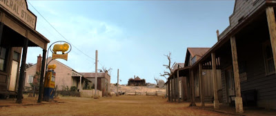
Now that 'The Dressmaker' film has hit the theatres and the DVD has been released, people are looking to see who and what they recognise (refer to earlier post 'Done and dusted' of filming scenes in the Wimmera). Here is a location guide to film settings, with screen shots from the DVD matched to actual places.
Dungatar looking up the hill to Molly's
Dungatar town exteriors - Mt Rothwell near Little River (room interiors - Docklands Studio)
The approach to Jung

Silo - distant views - Jung, except for the CGI superimposed on Mt Rothwell landscape (close-ups - Docklands Studio) 

 << The real Jung silos beside the Melbourne-Adelaide rail-line.

Below - the silos as in the film with Gyton Grantley (playing Barney McSwiney) sitting on the lid of the steel bin.
Jung silos looking west
 Dance exterior - Sailors Home Hall (interior - Williamstown)
Sailors Home Hall with the Blue Ribbon Rd in front
The Sailors Home Hall & toilet block
Molly's burial - Jerro Cemetery
Mourners at the Jerro Cemetery
The Jerro Cemetery, north of Jung on the Greenhills Road
Wedding church - unknown

Longerenong Homestead
Wedding breakfast - Longerenong Homestead
The marquee on the front lawn at the homestead
Side view of the Longerenong Homestead
Winyerp Theatre exterior - Murtoa (interior - Yarraville)
Murtoa's Mechanics Institute Hall

Football match - Jung Recreation Reserve
The massive gums surrounding Jung Rec Reserve
The pavilions at the Jung Rec Reserve
Train - Victorian Goldfields Railway (Muckleford Station and steam locomotive D3 639)

Leaving Muckleford for Maldon


Friday, 5 February 2016

Motoring on the rails

This Post is in reply to Steve Henderson's Comment on Brimming with memories, concerning a photo of a railmotor at Brim. 
So here is the photograph from the book "Victorian railway railmotors : a photographic profile 1950's-1980's" edited by Neville W. Gee and John Sargent.
The railmotor 57 at the now demolished Brim station
 Possible identities in the photograph are - (man leaning on the post), woman with handbag, woman in check skirt, Station Master Don Newick (man in VR uniform), Ralph Crisp (man with case), man with cases.
The Diesel-Electric Rail Motors (D.E.R.M.) first entered service in 1928 and the last was withdrawn from service in 1991. They had a maximum speed of 100km per hour, and a maximum of 54 passengers.

Between 1928 and 1931 the Victorian Railways purchased 10 Petrol Electric Rail Motors produced by the Electro-Motive Corporation of the US. Known as the E.M.C. Model M-300, these units were supplied for assembly by VR at the Newport Railway Workshops and were converted to diesel-electric between 1951 and 1953. These units carried the numbers 55 to 64.
 
In the book, there were a couple of other railmotors in the region:
  

DERM 64 in Hopetoun, taken looking north , the station building & platform have since been removed. The Goods Shed on the left is still on site.


DERM 57 was modified to diesel in December 1952. Retired in March 1982. Sold for scrap in November 1982.

DERM 63 was restored to 1930s livery and is now on the Daylesford Spa Country Railway.  

DERM 64 is apparently being restored.

(Below) DERM 63 at the dock platform in Murtoa, with the now demolished Signal Box behind, looking south.

Tuesday, 30 September 2014

Top award for the Stick Shed


Local icon - the Murtoa Stick Shed - is being placed on the National Heritage List next to natural places such as the Uluru-Kata Tjuta National Park and the Great Barrier Reef; other built heritage places - the Sydney Opera House, Port Arthur Historic Site, and Melbourne’s Royal Exhibition Building, and alongside our other local listing – the Grampians.


Australia's national heritage comprises exceptional natural and cultural places that contribute to Australia's national identity and encompasses those places that reveal the richness of Australia's extraordinarily diverse natural heritage.
This is Australia’s highest heritage honour, The Stick Shed, becomes just the 101st place of Australian cultural significance to be National Heritage listed.
 
The Stick Shed (The Marmalake No. 1 Grain Store) was born out of desperation and inspiration. Initially a temporary emergency building, it was erected during 1941 when the war prevented exporting the wheat harvest overseas. The Australian Wheat Board was left with a valuable resource a huge stockpile of grain, but insufficient, adequate storage for it.

Work started in September 1941 on a building designed to hold over 3 million bushels (92,500 tonnes) of wheat. The design was based on the same angle a pile of wheat forms naturally. Nearly 600 unmilled hardwood poles were used to hold up the roof.
The wartime restrictions meant that only raw, local and recycled materials were available, labour and machinery were scarce. Builders had to rely on ingenuity to overcome problems and shortages, they adopted common bush techniques to brace the poles.
What the builders erected was an adequate storage facility which has outlived its intended lifespan, but they also unintentionally created a serene cathedral-like interior amongst its forest of poles.  


Federal Environment Minister Greg Hunt said National Heritage listing meant the grain store was recognised as a significant part of Australia’s history and ensured it would be protected and celebrated for future generations. 
The Stick Shed is open this weekend on Saturday and Sunday from 10am to 4pm, as part of Muroa's Big Weekend - don't miss Australia's 101st National Heritage Site.

Friday, 13 December 2013

Styling stations


This post grew from this comment -
"Can someone please elaborate on 'Bealiba style'? I was brought up in Bealiba and spent years hanging around the Bealiba Station but have never heard of the term. Thanks Brian H." on the earlier post ‘Railways - Mildura line’ and led to a little research at the State Library.

The 1870s was an era of railway building, that ended with the financial crash of the early 1890s, when railway lines were extended westward. During this period, the development of a succession of standard plans coincided with the patterns of railway construction, establishing groups of stations common to sections of line.
Bealiba in 1980 (Andrew Ward)

There developed a "line style", in which similarly-designed station buildings imparted their distinctive character along a particular line. The Bealiba station building was one in the “light line” style along one of the “main trunk” lines and gave its name to a prototype style which was an economic solution to the previously costly construction of railway station buildings.

According to Andrew Ward in a ‘Study of Historic Railway Buildings and Structures’ and 'Victoria's Railway Stations: An Architectural Survey', the Bealiba Style is an earlier sub-group of the Rosedale Style. He says the Rosedale style developed in response to the need to save on construction costs,and was the first design to be widely employed for all-timber type buildings. In all, 12 Rosedale style buildings were erected (Cope Cope was the only example in this district) and 6 in the earlier Bealiba Style of station building - Bealiba, Broadmeadows, Euroa, Kilmore East, Lubeck, Murtoa and Wallan.
Lubeck in 1981 (from VRnet)
Constructed in 1878, the Bealiba building is still substantially intact as an example of the style. Elements of the Bealiba Style are: An oblong single-storey plan timber construction with bisecting longitudinal corridor which terminated at a porch. The combined station and residence had a verandah to the platform formed by an extension from the main roof. Four rooms were residential (2 bedrooms, parlour& kitchen) and 2 for railway purposes – the Booking Office and the Ladies Waiting Room. The 4 corner rooms all had fireplaces. The lamp room & toilets were all in the station yard. Copying the diminutive Dooen Style, the barge boards were fringed with cast-iron lace-work, and ornamental brackets adorned the porches. The verandah post capitals, gable vents and finials all had decorative timber work. The interior walls & ceilings, and lamp room & toilets were lined with tongue & groove boards.
Plan of the Bealiba building (Andrew Ward)

The later Rosedale style omitted the cast-iron lace-work, the end porches and 2 fireplaces, but now included a General Waiting Room.

Other stations in the area awarded a “style” are:

·     The "St. Arnaud style" (1879) comprised an architectural symmetrical single-storey hip roofed brick station with cast-iron platform verandah and pavilions and a standard U shaped plan for the station building. It is the most intact example of the largest standard station building design erected on the early light lines.

St Arnaud's water tower

Also the St Arnaud water tower was built as a standard 'Type B2' hemispherical design carried by a 'T' iron frame and installed onto a cement rendered brick column. It is the last remaining example of this construction, with other B2 type towers originally located at Cranbourne, Bealiba and some metropolitan locations.

Diapur station building in 1971 (from "VR stations & stopping places")

·     The “Kaniva Style” which in addition to Kaniva itself, included Diapur, Leeor (to Melton), Miram and Nhill. Small timber buildings with classical decoration & gables.

The ornate platform verandah, Minyip

·     The “Minyip Style” used for Minyip and Yarra Junction.

·     The “Rupanyup Style” used at Rupanyup and Bairnsdale

Past glories - the dilapidated Rupanyup building

A “Special Design” was used for Serviceton, Warracknabeal (1887) was built in the “Casterton Style” a Tudor/Late Victorian look, while Dimboola (1882) is in the “South Melbourne Style” the Italianate/Late Victorian style.

The same style - Donald & Birchip